2016 Family Summer Vacation - Drive Home


Summer Vacation 2016...
... awesome!
(created Sep. 3, 2016)


image sources:
http://www.scstatehouse.gov/studentpage/coolstuff/seal.shtml
&
https://en.wikipedia.org/wiki/Flag_of_Missouri
We visited:
-
-Augusta, GA
-
-Charleston, SC
-
-Hilton Head Island, SC
-
-and we slept an overnight in both directions in Nashville, TN
And we had one of our best, most relaxing family trips... ever.
Itinerary, and links to other sites, and photos, are below.
Family Summer Vacation 2016
Driving Home
We wanted to enjoy as much time in the ocean as possible, so we got a late check out, packed the van, kept some dry clothes available, and enjoyed one more day in the sun.
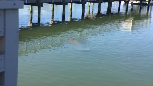
After we rode our last wave, and showered, we were hungry. So we went to the Salty Dog for the first time in a long time. It’s names for Jake, who, after their ship sunk in a great storm, swam for three days to bring his owner back to shore.
It’s at the southern tip of Hilton Head, and they serve great good and ice cream. As we waited for our food, from our patio table, we saw a manatee swim by under us!
We got a late start, getting onto the Interstate at 7pm. We pulled into Nashville at 2am. Dad was quite tired. We slept as long as we could and drove on the next morning.
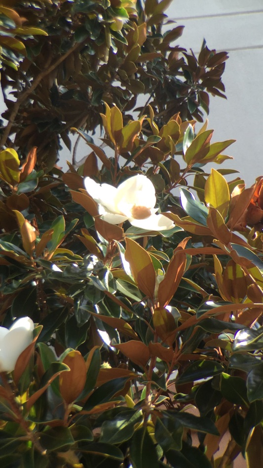
As we got moving, Abby took a photo of a flower on one of the hotel’s trees.
Matt had been eager for Applebee’s since before we left. When we realized Paducah, KY, we stopped for lunch.
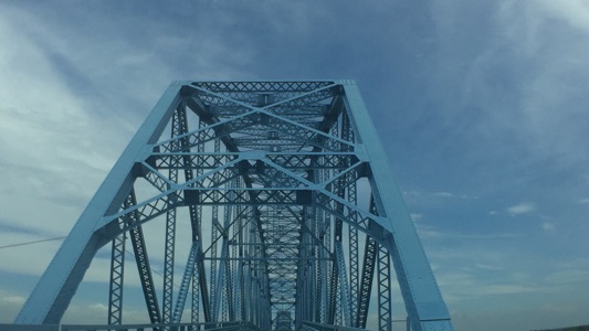
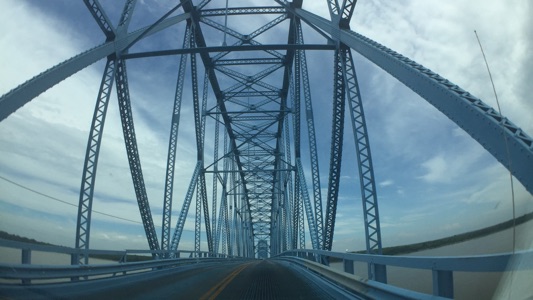
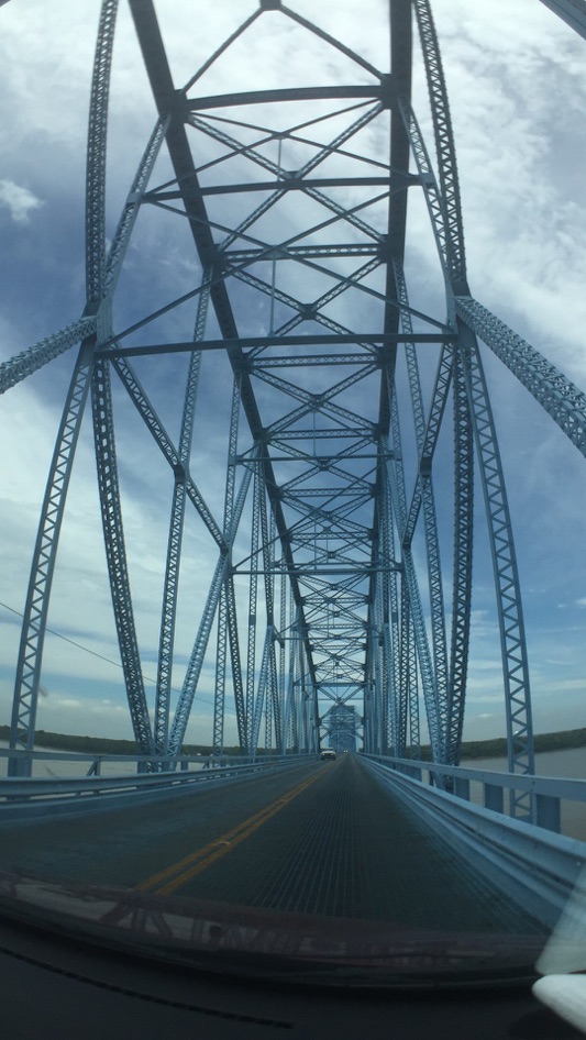
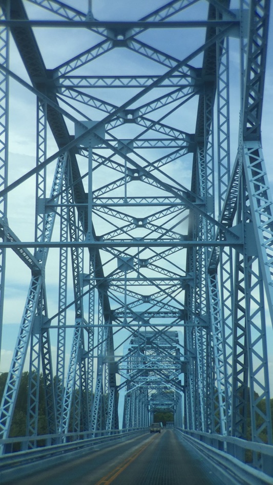
As we went to leave, Dad saw we could get back on the Interstate and cross the Ohio River into Illinois, or we could stay on the business route and cross on another bridge, and we could see a Lock and Dam. So we decided on the business route.
We crossed an impressive blue bridge, the Highway 45 Paducah (KY) - Brookport (IL) bridge.
http://bridgehunter.com/il/massac/brookport/
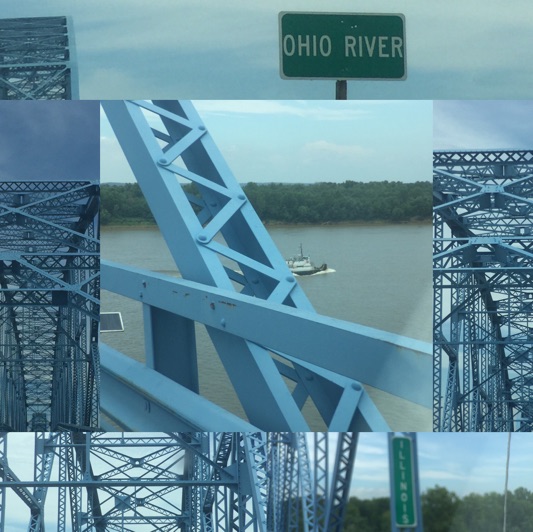
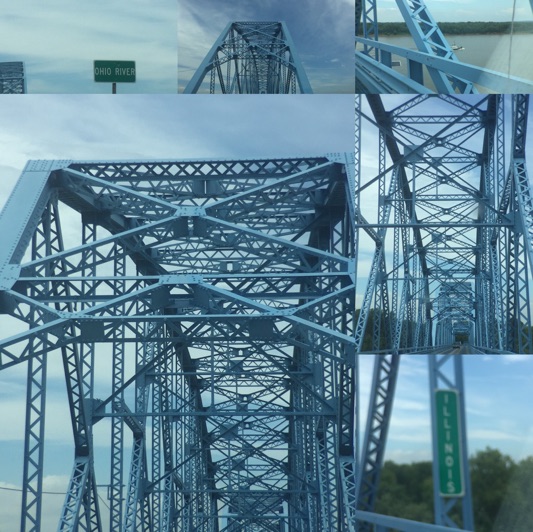
These latter two photo collages were created using Instagram’s “Layout” iPhone app.
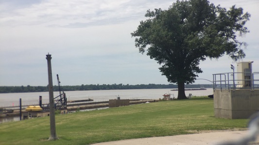
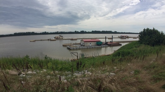
We drove through the nice, but quiet, town of Brookport to the lock and dam. We were surprised it did not look like the Melvin Price Locks & Dam in Alton, IL.
https://www.instagram.com/p/dM34Blyfrt/
& see also
http://vanvooren.us/VV/St._Louis.html
Dad called the US Corps of Engineers, and the gentleman on the phone was quite helpful.
He explained how this and a couple other dams on the Ohio River are different... they are in use only when the water level is below 16 feet deep. At that time, the Corps personnel work their way across the river using poles to pull the wickets up from the bottom of the river, so that the wooden wickets stand up, backing the water high, at which point the barges must use the locks.
Links:
-
-https://m.facebook.com/pages/Lock-and-Dam-52/155267911207054
-
-http://www.southernmostillinoishistory.net/ohio-river-locks-and-dams.html
-
-wicket dams - http://wicketlock.blogspot.com/2007_07_01_archive.html?m=1
YouTube Videos:
-
-Raising the Wickets
https://www.youtube.com/watch?v=OA7aueKsFdA&feature=youtu.be -
-History of Locks and Dams 52 & 53
https://www.youtube.com/watch?v=Is-_SKgQmIE&feature=youtu.be -
-Brookport Bridge to Massac Park, Illinois
https://www.youtube.com/watch?v=YmLjsF1Zstk&feature=youtu.be -
-Brookport Bridge to Brookport
https://www.youtube.com/watch?v=IS-SE2tRvBk&feature=youtu.be
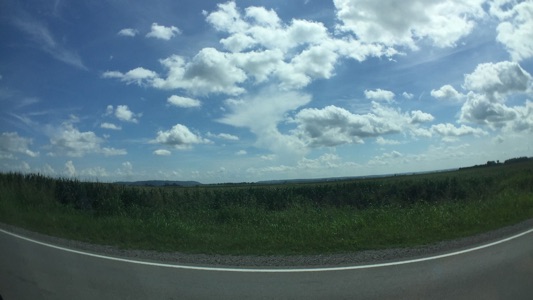
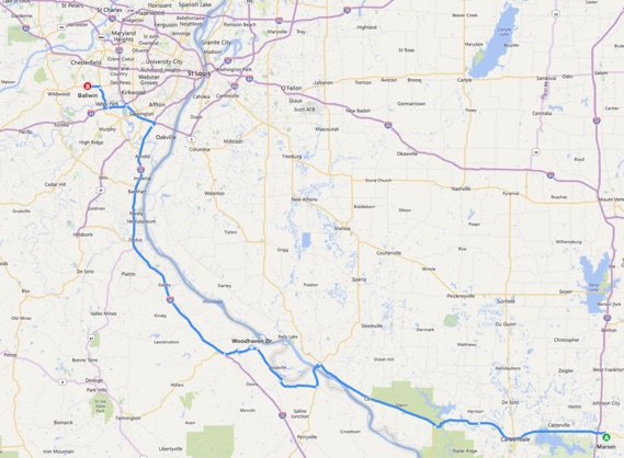
To avoid St. Louis rush hour traffic, Ann Marie astutely recommended we turn right at Marion, IL, drive through Carbondale to Chester, IL and that we come on in home via St. Genevieve and I-55 - I-44.
That was a great recommendation.
Not only had none of us ever seen this beautiful part of southern Illinois, ...
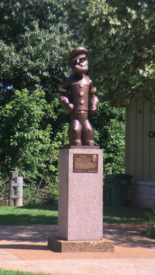
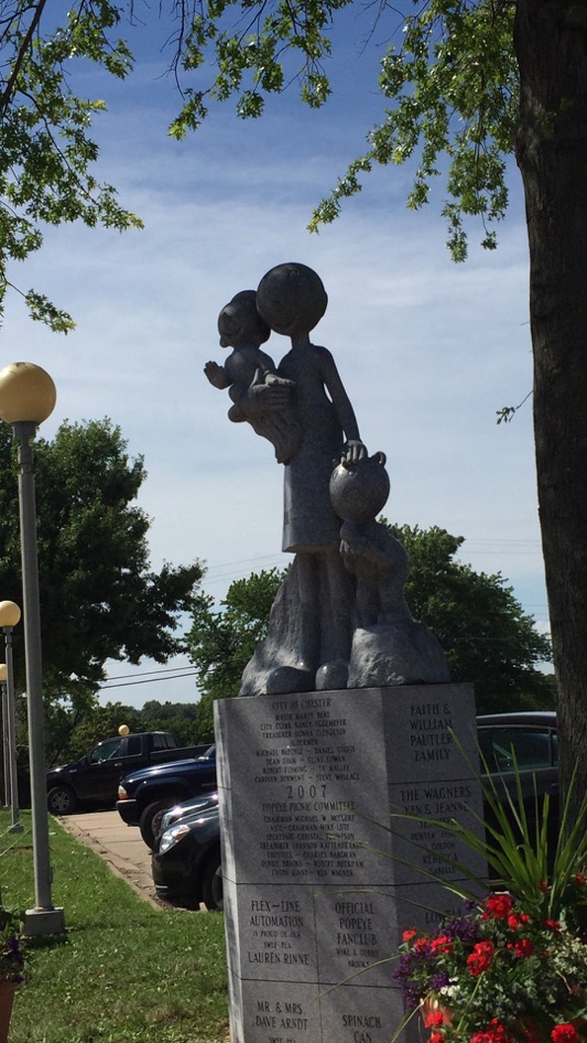
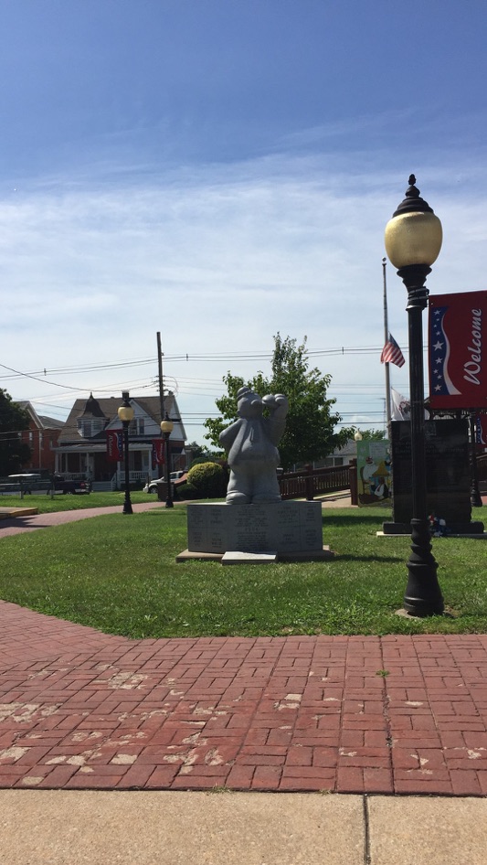
...but we saw Chester, the birthplace of Popeye, ...
... and we also saw some great lowlands on the Missouri side, ...
... where we were introduced to where we would see the Great American Eclipse of 2017 - the center line of totality went right over the Perryville Municipal Airport, and we were there!
<insert link>
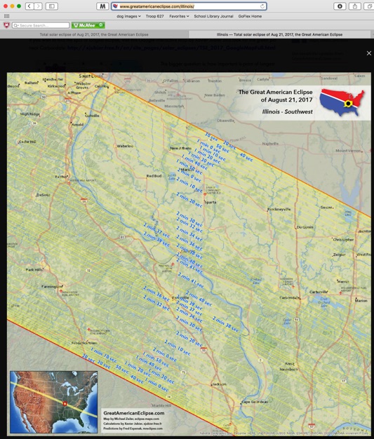
The area I mention is almost due center... near the Perryville Area Airport, between the “2 min 41 sec” marks.
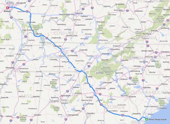
Map / Directions: US 278 to I-16 to I-75 to I-24 to I-64:
Map / Directions: from our awesome change of directions, Marion through Carbondale and Chester and Perryville:
Links to the rest of this travel journal:
HHI 2016 - Charleston, SC - p. 1
HHI 2016 - Charleston, SC - p. 2
HHI 2016 - Angel Oak & Sheldon Church Ruins
HHI 2016 - Hilton Head Island, SC, p. 1
HHI 2016 - Hilton Head Island, SC - p. 2
see also http://vanvooren.us/VV/HIlton_Head.html